The proposed development will create a sustainable and high-quality neighbourhood, delivering:
Up to 180 new homes, including up to 50% affordable housing to meet local needs.
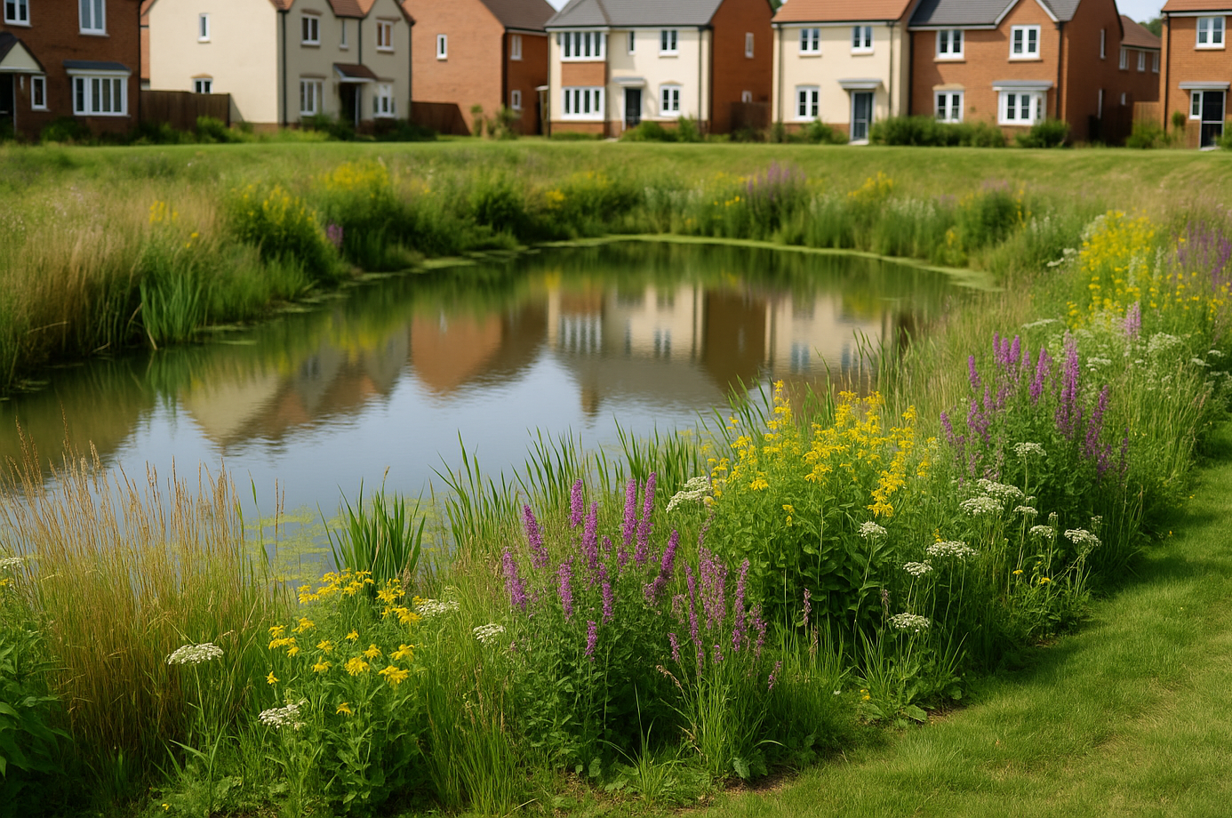
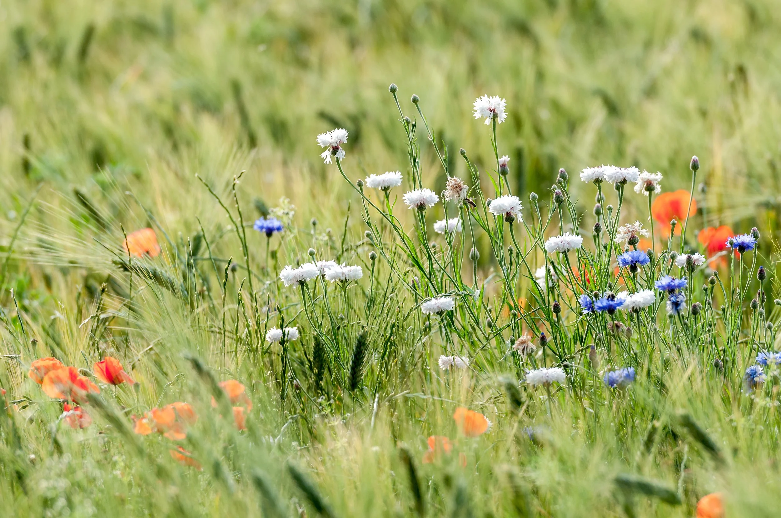
Significant green space, including recreational space, wildlife habitats and new wildflower planting.
Economic benefits to support the local economy, including job creation during construction and increased spending in Kenilworth by new residents.
Community benefit through a potential extension to the St Johns Allotments for both existing and new residents, and the creation of public open space within the Site.
Contributions to improvements in local services, such as schools, to cater for the demand generated by the development.
A landscape-led design, integrating sustainable drainage and enhancing vegetation to provide a biodiversity net gain and improve wildlife connectivity.
The Proposal
Click to expand image
Access into site
Access into the Site will be taken from Rouncil Lane along the Site’s western boundary in the form of a T junction. Alongside vehicle access, a 2m footway is proposed to tie into existing provision to the north along Rouncil Lane.
A comprehensive Transport Assessment is currently being prepared to accompany the planning application, which will assess the impact of the proposed development on the local highway network and establish whether any off-site improvements are required to ensure that the development does not have an unacceptable impact. The application will also be accompanied by a Travel Plan to encourage residents of the Development to use sustainable modes of transport and to reduce the number of single occupancy car trips generated by the development.
Drainage
The Site is identified to be wholly located in Flood Zone 1 (i.e. is considered to have <0.1% Annual Exceedance Probability (AEP) of flooding from rivers) and is predominantly identified to be at very low risk of surface water flooding. There is a small area of surface water flood risk flowing through the Site.
A sequential approach has been implemented within the Site, whereby all proposed development has been directed towards areas at lowest flood risk.
The proposed development will incorporate a sustainable surface water management strategy, implementing multiple sustainable drainage systems (SuDS). This strategy aims to mimic the hydrological regime of the existing Site, aiming to ‘slow the flow’ of surface water through the proposed development, capturing this at source, attenuating and treating this before discharging to the local water course.
The Historic Environment
Proposals for the Site have been informed by an Archaeology and Heritage Assessment and this is informing the preparation of the planning application.
The collation of desk-based information and the completion of site visits and walkover surveys has been undertaken.
The proposals for the Site are not considered to have an impact on the significance of the designated and non-designated heritage assets located in the wider surrounding area, including Kenilworth Castle. Consultation of desktop sources and the completion of a non-intrusive geophysical survey is currently being carried out.
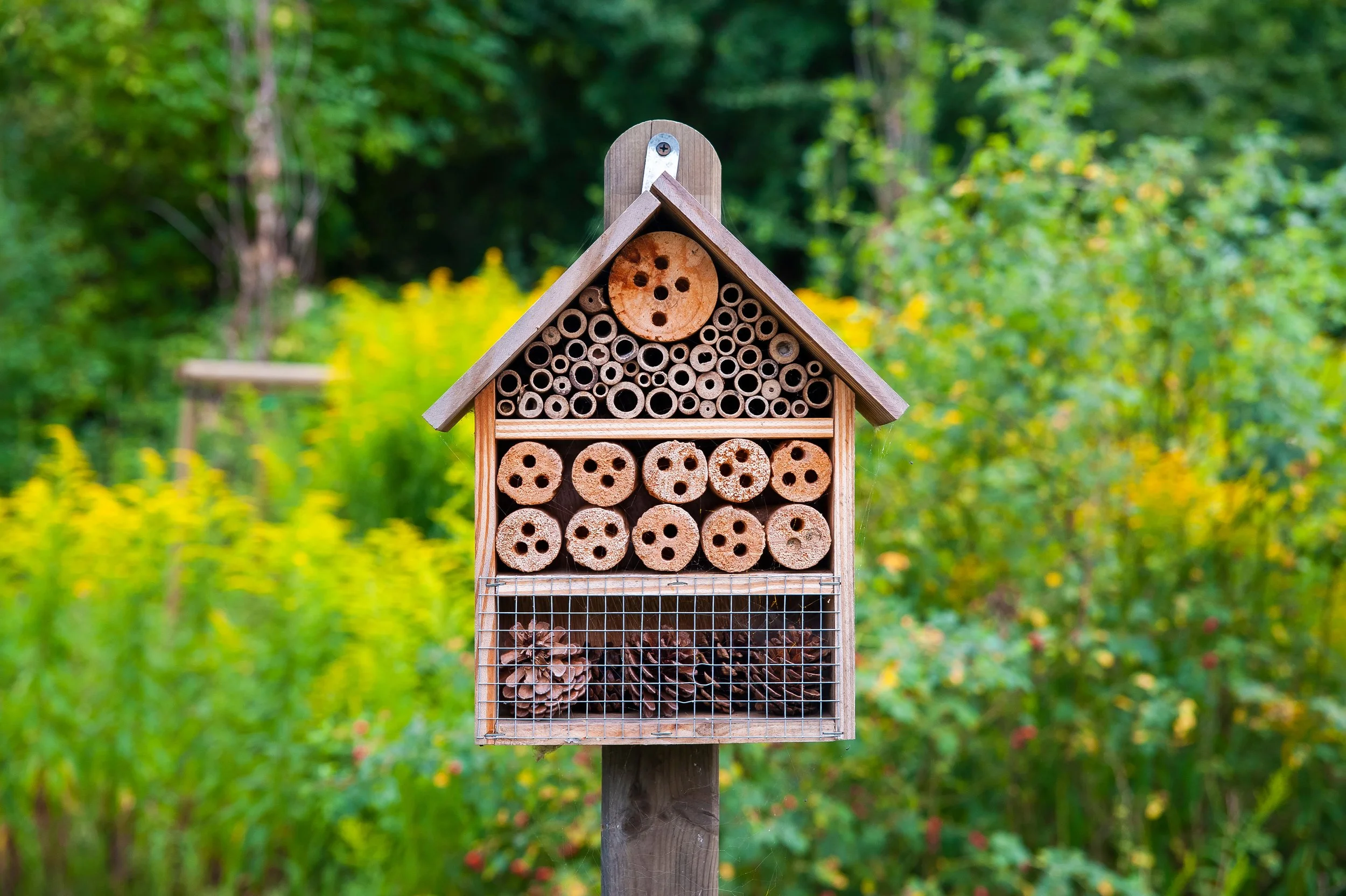
A suite of ecological surveys will be undertaken to assess the conservation value of habitats and species present across the Site, in accordance with relevant industry-standard guidance. Preliminary consideration of the Site indicates the presence of a range of habitats, including an arable field, hedgerows, woodland, grassland, scrub, and a ditch and stream corridor.
The proposals have been informed by the retention of key ecological features, including woodland areas and a large area to the south of the Site, which is expected to be retained and enhanced to provide suitable habitat for wildlife. All measures will be developed in line with Biodiversity Net Gain (BNG) principles, with opportunities for additional habitat creation and long-term ecological enhancement.
Ecology
A Landscape and Visual Appraisal is being undertaken to provide a thorough understanding of Kenilworth’s landscape, its character, and key views. This assessment ensures the proposals respond sensitively to the setting and minimise visual impact. The masterplan keeps the visually sensitive southern section of the site free from development, preserving its open character. New green spaces will be created, including the retention of mature trees, hedgerows, and other green features, alongside new planting, which will help reduce visual impact and provide benefits for residents and wildlife.
Landscape
A tree survey of all trees within and adjacent to the Site has been undertaken. This assessment, which has had a strong influence upon the proposed development is to be submitted in support of the application.
It is considered that there is a valuable opportunity to offer significant longer-term enhancement to the visual amenity and succession of the tree population as part of the development. In particular, investment in more consistent and targeted management combined with replacement planting would considerably improve the diversity and quality of the tree stock on Site.
Arboriculture
Noise
The impact of existing noise sources on the proposed development and the extent of any mitigation required will be quantified in a noise impact assessment to be submitted with the planning application.
Where required, appropriate mitigation measures will be incorporated into the design of the new homes to achieve the requirements of relevant policy, standards and guidance. In particular, properties will be designed so that appropriate sound levels are achieved both internally and in gardens.
Air Quality
The proposed development's sensitivity to, and impact on, local air quality will be quantified in an air quality assessment to be submitted with the planning application.
Where required, appropriate mitigation measures will be incorporated into the design of the new homes to achieve the requirements of relevant policy, standards and guidance.